Up and down

→ on

Richmond Avenue →

A straight line that reveals where Houston’s priorities begin and end

By Leah Binkovitz
Maps by Evan O'Neil

In her early years in Houston, Zoe Middleton’s commute would take her east toward downtown along Richmond Avenue.

That drive presented some of the many sides of the city, says Middleton, the Houston and Southeast Texas co-director for Texas Housers. “You see the whole state of buildings where people live,” she says, “these weird glass high-rises to single-family homes to multifamily that’s in need of a lot of attention and repair, and you see the difference in amenities.”

You see Houston, in short.

It’s a corridor of change. Near the Beltway, a single strip mall might feature Salvadoran, Cuban and Colombian restaurants with a Guatemalan bakery, an event venue, beauty supply shop and Pizza Hut.

The street also serves luxury car dealerships, members-only big box retail, and, closer to downtown, shimmering office towers in Greenway Plaza, mixed-use buildings like Kirby Grove with their own parks attached in Upper Kirby and bars, restaurants, grocery stores, art galleries and museums in gentrifying Montrose.

Before it changes names and becomes Wheeler Avenue in what used to be Third Ward, Richmond forms the rough southern boundary of a stubborn shape that most map-minded Houstonians have come to know by heart.

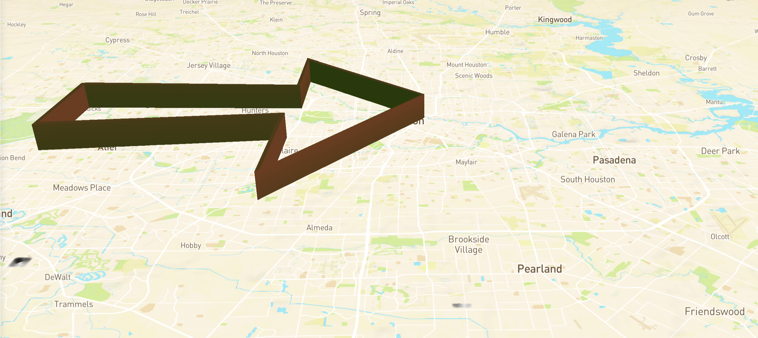
It’s a shape so distinct it has a name. “I think of Richmond as a way of experiencing the Arrow,” Middleton says.

Whether you're looking at:

Poverty rate

College degree or higher

Facilities that handle harmful chemicals

Median home value

Solid waste facilities

Rates of childhood asthma

Rates of COVID vaccinations

Percentage of white population

you will see almost the same map of Houston —
and on that map you will see ...

The Arrow.


Roughly, it includes a swath of the west side of Houston emerging around the Barker and Addicks reservoirs, encompassing neighborhoods south of Interstate 10 and north of the Westpark Tollway and Interstate 69 and ending in a triangle pointing right at downtown, with the tips meeting in the Greater Heights to the north and Rice Village, Southside Place and West University to the south.

It’s proved useful for Middleton and organizations like Texas Housers that work with data every day, because it efficiently summarizes inequity across the city, and its consistency speaks to the interconnected, cumulative nature of advantage and disadvantage, two pieces of the same process. Because clusters like the Arrow don’t just happen. They are not a byproduct of inequity somewhere else. They concentrate resources in a way that then entrenches that inequity. They are not just wealthy enclaves — where people with money retreat — but wealth producers.

The specific social determinants of health — schools, parks, libraries, infrastructure — get healthier. The rich, then, get richer.

Even without knowing what the Arrow is, most Houstonians would recognize the core neighborhoods inside it, places like River Oaks, Memorial Villages. They represent a semi-permanent feature of the landscape, their winding roads and tree-shaded mansions a testament to the wealth of one of the country’s largest cities. But understanding how they came to be, what helped the Arrow take shape, shows that such a stark concentration of opportunities inside a particular group is not inevitable. It required — and now benefits from — direct and indirect support over many years from a city simultaneously touting its welcoming affordability and diversity.

Spaces of neglect, extraction and abuse — maybe the ones outside the Arrow — are often, understandably, the focus of policies meant to address legacies of housing discrimination or environmental racism. Sometimes communities that have borne the brunt of it all are framed as isolated and marginalized. But zooming out on the map to include clusters like the Arrow shows the limitations of this narrow framing. The so-called margins become load-bearing walls for the assumed center.

Challenging the structures that have built up and served the Arrow demands a full consideration of the city’s geographies of power.

Data sets for chemical facilities, childhood asthma rates, solid waste sites, and median home values provided by Corey Williams of Air Alliance Houston.

Mapping almost anything in Houston, you end up with the same map, with a shape so persistent, so apparent, it's been given a name: The Arrow. How did the city take this shape? How has it held it? And how can we make Houston whole? This four-part series sets out to answer these questions.